Trail Running in Chiang Mai



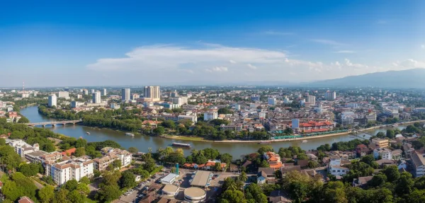
Chiang Mai is northern Thailand’s primary mountain running destination, hosting the Asia-Pacific Major for the UTMB World Series and hundreds of kilometres of mapped singletrack rising directly from the western edge of the valley. Trailheads just outside the city begin at roughly 350 metres above sea level, with routes climbing into Doi Suthep–Pui National Park and extending across the province to the summit of Doi Inthanon at 2,565 metres, the country’s highest peak.
The provincial trail network threads through protected national parks, evergreen cloud forests, and upland Karen and Hmong farming corridors. Local infrastructure supports both competitive ultra-marathon runners and recreational athletes, anchored by community hubs such as Basecamp Trail Provision and Cafe at the foot of the Suthep trails. The terrain delivers sustained vertical ascents, runnable ridgelines, and technical root-strewn descents that contrast sharply with the coastal running routes of southern Thailand. The sport draws road runners transitioning to off-road terrain, fell runners accustomed to steep technical climbing, and long-distance athletes preparing for international mountain events.

Doi Suthep–Pui Foothills and Ridgeline Circuits

Immediate trail access directly from the western boundary of Chiang Mai distinguishes Doi Suthep–Pui National Park from most other mountain running destinations in Southeast Asia.
From the foot of the mountain behind Chiang Mai University, runners can jog straight from the asphalt near Suthep Road onto the historic Pilgrim's Trail, commonly known as the Monk's Trail. The initial trail segment climbs through mixed deciduous forest past the stream gullies and stone bridges of Wat Pha Lat before steepening into technical root steps towards the gilded temple of Wat Phra That Doi Suthep at roughly 1,050 metres. Well-conditioned runners continue higher along pine-needle ridgelines past Bhubing Palace to reach the summit of Doi Pui at 1,685 metres, or follow singletrack trails through upland coffee smallholdings into the Hmong village of Khun Chang Khian. Approximately 12 kilometres north of the city centre along the base of the range, the perimeter of Huay Tung Tao reservoir provides a flat dirt loop of roughly 3.5 kilometres. From this lakeside base, an 18-kilometre backcountry loop ascends 1,350 metres of elevation gain up the northern mountain flank along the Huay Koh Luang waterfall ravines. Underfoot conditions alternate between hard-packed red clay, slick granite slabs, and exposed root ladders. Because these foothill trailheads sit within a 10- to 15-minute drive of Nimmanhaemin and the Old City, completing a 1,000-metre vertical ascent before breakfast requires little travel overhead.
Training blocks often centre on the trailheads around Galae Reservoir and Basecamp Trail Cafe, an established runner hub that provides route information, gear supplies, and convenient transport connections back into the city.
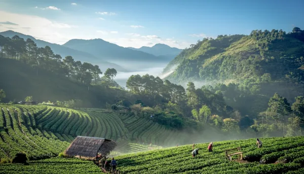
Further afield, Chiang Mai province contains dramatic shifts in elevation and climate across outlying conservation areas. Doi Inthanon National Park, situated roughly 90 to 120 minutes south-west of the provincial capital, protects Thailand's highest summit at 2,565 metres above sea level. Between November and January, morning temperatures near the peak regularly drop into single digits Celsius, occasionally touching freezing. Mountain routes here traverse moist evergreen cloud forest, peat bogs, and terraced paddy ridges maintained by Karen and Hmong farming communities. High-altitude nature paths including Kew Mae Pan and the Pha Dok Siew waterfall trail feature wet timber steps and slick clay ravines. Both trails operate under local conservation rules requiring registered community guides, and Kew Mae Pan closes annually between June and October to allow the fragile ridge flora to regenerate.
To the north, the limestone massif of Doi Luang Chiang Dao rises to 2,175 metres above sea level, standing as Thailand's third-highest peak. Set within the Chiang Dao Wildlife Sanctuary—designated a UNESCO Biosphere Reserve in 2021—the mountain features jagged karst ridges, alpine meadows, and sustained climbing gradients exceeding 20 percent. Access is strictly managed: trail access requires advance reserve permits, mandatory ranger accompaniment, and observance of seasonal dry-season fire closures. Tackling long outings across Doi Inthanon or Chiang Dao requires dedicated mountain footwear, trekking poles, and windproof thermal layers to manage rapid weather shifts and sharp temperature drops above 2,000 metres.
Regional Comparison: Chiang Mai Versus Southeast Asian Trail Hubs

Chiang Mai holds a distinct position among Southeast Asian trail running destinations. While neighbouring mountain hubs feature higher altitudes or volcanic summits, Chiang Mai combines trail density, runnable singletrack, and immediate urban access in a way no regional alternative matches.
Mount Kinabalu in Malaysian Borneo rises to 4,095 metres at Low's Peak, which provides high-altitude climbing. However, the Timpohon route functions primarily as a continuous staircase of engineered timber steps, tree roots, and steep granite slabs. Daily permit quotas and mandatory guides make spontaneous long runs impossible. Mount Rinjani on Lombok in Indonesia reaches 3,726 metres, with massive continuous ascents. Yet its upper flanks consist of deep volcanic ash and loose scree where foot strikes slide backwards with every step, and the national park closes completely during the wet season from January to March.
Vietnam provides two contrasting environments. Sapa, set beneath the 3,143-metre summit of Fansipan, features terraced valley landscapes. In wet periods, however, agricultural clay turns into slick mud that slows running pace to a heavy hike, and reaching the trailhead requires a five- to six-hour road transfer from Hanoi. Da Lat in the Central Highlands features runnable pine-needle forest paths and rolling dirt fire roads between 1,400 and 2,167 metres around Mount Langbiang. While Da Lat is pleasant and flowing, it lacks the sustained technical ridgelines, elevation variety, and deep trail networks found in northern Thailand.
Chiang Mai provides firm clay, loamy forest singletrack, and rocky ridgelines linked by trade paths historically established by Karen, Hmong, and Lahu communities. From accommodation in the city, trailheads on the lower slopes of Doi Suthep sit fifteen to twenty minutes away. Specialised running cafes, international transport links, and modern hospitals remain directly on hand.
The table below contrasts Chiang Mai's primary trail conditions against other major Southeast Asian mountain hubs:
| Destination | Primary Trail Surfaces | Peak Elevation (m) | Trailhead Accessibility | Runnability Factor |
|---|---|---|---|---|
| Chiang Mai, Thailand | Packed red clay, loamy forest floor, tree roots | 2,565m (Doi Inthanon) | 10–20 mins from city centre | High; sustained singletrack loops |
| Sapa, Vietnam | Slick agricultural mud, stone staircases, buffalo tracks | 3,143m (Fansipan) | 5–6 hours from Hanoi airport | Moderate; heavy mud slows pace |
| Dalat, Vietnam | Pine needle singletrack, rolling fire roads, red dirt | 2,167m (Langbiang) | 30–45 mins from town centre | High; gentle undulating gradients |
| Mount Kinabalu, Malaysia | Engineered timber steps, exposed granite plateau | 4,095m (Low's Peak) | 2 hours from Kota Kinabalu | Low; power-hiking and stair ascents |
| Mount Rinjani, Indonesia | Volcanic ash, loose scree, steep crater ridge paths | 3,726m (Rinjani Summit) | 3–4 hours from Lombok airport | Low to Moderate; loose sliding scree |
Discover the real cultural rules of Chiang Mai, from ancient Lanna spirit worship to sharing a communal khantoke meal and navigating local temple etiquette.
Organised Ultra Races and the UTMB Major
Chiang Mai serves as the competitive capital of Southeast Asian trail running, anchored by the Asia-Pacific UTMB World Series Major. Known as Chiang Mai Thailand by UTMB (originally founded as Doi Inthanon Thailand by UTMB), the event is one of three continental Majors worldwide. Finishing an event at Major status awards runners double Running Stones toward the UTMB Mont-Blanc ballot, while top category finishers earn direct qualification for the World Series Finals in Chamonix. Distances range from shorter 10km and 20km loops to the flagship Trans-Int 160. This point-to-point 100-mile race covers approximately 172 to 175 kilometres with roughly 9,000 to 10,000 metres of climbing across Doi Inthanon, Ob Khan, and Doi Suthep–Pui National Parks to the finish at Chiang Mai PAO Park.
Other major fixtures include the Pong Yaeng Trail (PYT), held each October from Queen Sirikit Botanic Garden across the Mae Rim and Samoeng valleys, featuring distances from 18km up to 100km and 160km. The long-standing CM6 ultra traces the ridgelines encircling the Chiang Mai basin. Aid stations at these northern Thai events are well stocked with sliced watermelon, sticky rice, electrolyte drinks, hot noodle soup, and medical support. Runners should enter autumn and winter events five to six months in advance, as Major-status UTMB categories reach runner caps quickly.
Guided Excursions, Coaching Camps, and Local Trail Infrastructure

Navigating northern Thailand's mountain backcountry is significantly eased by local guiding agencies, seasonal training camps, and community-centred running hubs. Because many ridgeline tracks and forest spurs connecting highland villages are unposted, runners tackling remote terrain often rely on guided itineraries or local route intelligence.
Licensed agencies such as Thailand Mountain Trail organise structured running journeys ranging from single-day mountain outings on Doi Suthep to five-day stage crossings. Their signature 150-kilometre TMT.1 route traverses roughly 8,000 metres of elevation gain between Chiang Mai city and Chiang Dao, with overnight stops in mountain settlements and homestays. Specialist coaching camps and race-preparation retreats also operate throughout the year, including multi-day workshops focusing on pacing, nutrition, and technical descending across sections of the Doi Inthanon and Doi Suthep–Pui trail networks.
The resident trail community centres on Basecamp Trail Provision and Café, situated at the base of Suthep mountain behind Chiang Mai University. Located moments from the trailheads for the Monk's Trail and Bamboo Trail, the venue operates as an informal clubhouse. Runners gather here for espresso, route advice, and trail-tested GPX files. The attached gear shop stocks trail running footwear, hydration vests, and energy nutrition, with day lockers and showers available for runners returning from the mountain.
For active recovery, flat road loops and university athletic tracks provide alternatives to mountain gradient; consult our guide to Running in Thailand for nearby park and campus circuits. Cross-training endurance athletes can also tackle the paved switchbacks climbing towards Bhubing Palace, which connect with routes detailed in Cycling in Chiang Mai for road cycling and mountain biking.
Location and Getting There
Chiang Mai's primary mountain trailheads sit along the western and northern edges of the provincial capital, within easy reach of central accommodation districts. The lower access points for Doi Suthep–Pui National Park, including the Monk's Trail (Wat Pha Lat), begin in Suthep sub-district, roughly five kilometres west of the Old City and three kilometres from the Nimman area. To the north, the Huay Tung Tao reservoir trail loop lies twelve kilometres out along Canal Road (Highway 121).
UK travellers reach Chiang Mai International Airport (CNX) via connecting flights through Bangkok (Suvarnabhumi or Don Mueang), Singapore, or Kuala Lumpur. Because the airport sits four kilometres south-west of the Old City, transfers take ten to fifteen minutes. Official airport taxi desks charge a fixed fare of 150 to 200 THB (£3.50 to £4.60) into town.
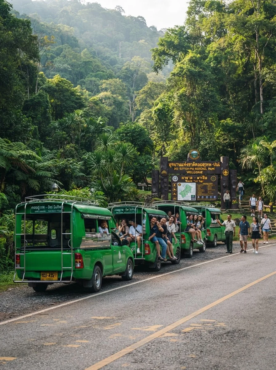
Local transport to nearby trailheads is straightforward. Shared red songthaews running from Nimman to the lower Doi Suthep trailheads cost around 40 to 60 THB (£0.90 to £1.40) per person, whilst private rides via Grab cost 100 to 140 THB (£2.30 to £3.20). Reaching outlying trail systems requires private transport. Doi Inthanon’s mountain routes sit 85 to 100 kilometres south-west via Highway 108 and Highway 1009, taking ninety minutes to two hours by car. To the north, Doi Luang Chiang Dao lies 75 kilometres away via Highway 107, taking around eighty minutes. Private car hires with a driver typically cost 1,800 to 2,200 THB (£42 to £51) per day, while self-drive car hire starts from 800 to 1,200 THB (£19 to £28).
Costs and Booking
Trail running independently across Chiang Mai is remarkably economical, with minimal mandatory expenses beyond park fees and transport. Foothill paths across Doi Suthep–Pui National Park, including the Monk’s Trail up to Wat Pha Lat and the Galae trail network, remain open access and free of charge. Runners venturing into upper protected zones or formal park checkpoints encounter Department of National Parks booths, where foreign adults pay an official entry fee of 100 THB (around £2.30). Entering Doi Inthanon National Park costs 300 THB (around £7.00) for foreign adults, plus 30 THB (£0.70) for a car or 20 THB for a motorbike, collected in cash at the gate. Huay Tung Tao reservoir charges a 50 THB (around £1.15) foreign visitor admission fee at its entrance checkpoint.
Commercial guiding and training camps scale with duration. Single-day guided trail runs from local specialists range from 1,900 to 4,500 THB (£44 to £105) per runner, covering route guiding, vehicle transfers, and trail refreshments. Comprehensive five-day trail running camps cost between 28,000 and 55,000 THB (£650 to £1,280) per person, bundling structured mountain coaching, point-to-point luggage transfers, and rural village lodging.
| Option | Cost (THB) | Cost (GBP approx) | Notes |
|---|---|---|---|
| Doi Suthep Foothill Trails | Free | Free | Open access on Monk's Trail and Galae paths |
| Doi Inthanon Park Entry | 300 THB per person | £7.00 | Mandatory foreign adult national park entrance fee |
| Huay Tung Tao Lake Entry | 50 THB per person | £1.15 | Mandatory foreign visitor gate fee for trail access |
| Guided Single-Day Trail Run | 1,900–4,500 THB per person | £44–£105 | Includes licensed mountain guide, transfers, and trail lunch |
| 5-Day Guided Trail Running Camp | 28,000–55,000 THB per person | £650–£1,280 | Includes stage coaching, mountain lodging, and logistics |
| UTMB Thailand Short Race (10k–20k) | 1,500–3,200 THB per entry | £35–£74 | Official race timing, bib, finisher medal, and aid stations |
| UTMB Thailand Ultra (50k–100k) | 4,300–8,600 THB per entry | £100–£200 | Includes tracking, medical cover, race jersey, and stones |
| Trans-Inthanon 100-Miler Entry | 8,500–11,500 THB per entry | £198–£267 | 175km race entry, drop-bag transport, and ITRA points |
Entry fees for competitive mountain races scale by distance and registration tier. Short categories (10km to 20km) cost 1,500 to 3,200 THB (£35 to £74). Mountain ultramarathons covering 50km to 100km range from 4,300 to 8,600 THB (£100 to £200), while premier 100-mile events like the Trans-Inthanon 160 cost 8,500 to 11,500 THB (£198 to £267). Major races under the UTMB World Series banner open registration months ahead with tiered pricing that rises as quotas fill. Valid UTMB Index holders receive a priority window before general public registration opens, and race processing systems typically apply an additional 6% to 8% booking fee.
Who It Suits
Chiang Mai suits endurance athletes, fell runners, and experienced trail runners seeking steep vertical climbing, technical singletrack descents, and warm-weather training. Road runners stepping up to ultramarathon distances also find valuable ground here, particularly along runnable dirt tracks and moderate gradient loops across the lower flanks of Doi Suthep. Solo sports travellers and remote workers benefit from having mountain trailheads starting minutes from the city centre, alongside active running groups and trail-friendly cafes.
The terrain is poorly suited to casual walkers looking for gentle, paved, or flat park loops. Northern Thailand's mountain paths are working forest tracks rather than manicured recreational paths: expect exposed tree roots, loose granite scree, slick clay, and sustained elevation change. Runners unaccustomed to tropical humidity, midday heat, or navigating off-road terrain without waymarkers should build foundational trail skills elsewhere first.
What to Know Before You Book
Northern Thailand experiences an intense agricultural burning season from mid-February through April that makes outdoor endurance running hazardous. Smoke accumulation across the Chiang Mai valley routinely pushes PM2.5 concentrations to Air Quality Index readings above 150 to 200, creating genuine respiratory risks. Runners should plan mountain trips between late May and late January. The clearest conditions arrive from November through January, when daytime temperatures drop and ridgelines stay dry, whereas the wet months from June to October bring slick clay paths.
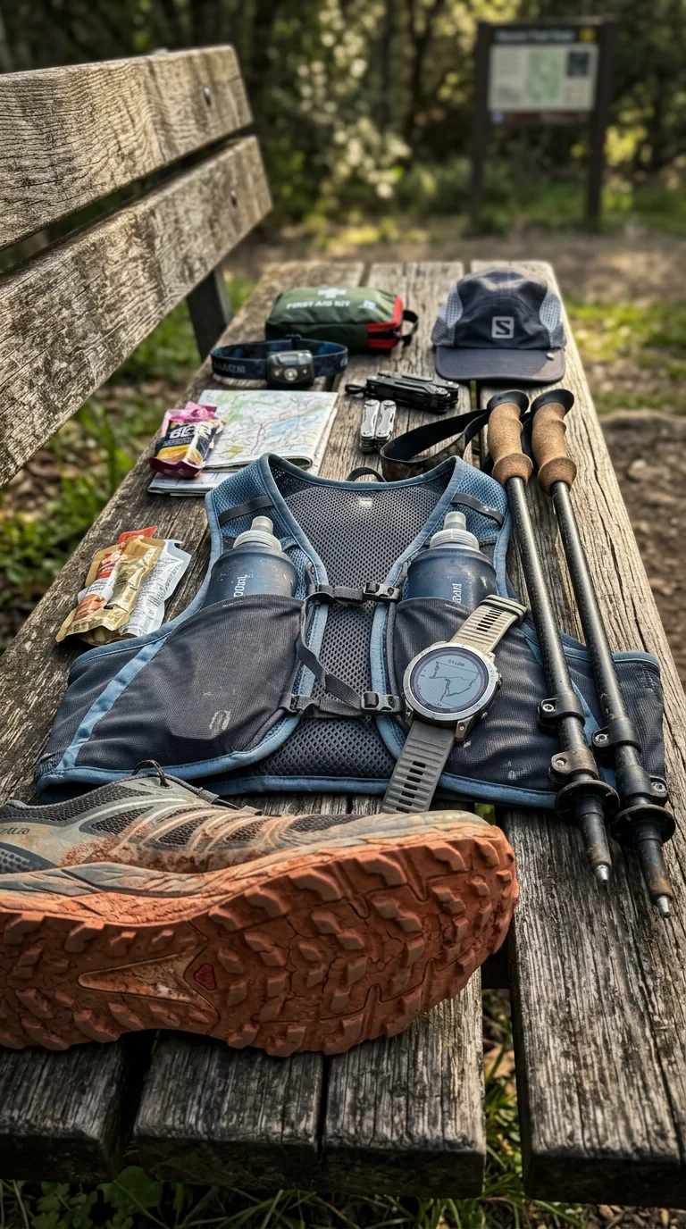
High humidity substantially accelerates sweat rates and sodium loss compared to running in temperate European climates. Carrying 1.5 to 2 litres of fluids alongside electrolytes is standard practice even on morning runs, as natural mountain streams carry runoff and are unfit for drinking untreated. Trail waymarking in regional national parks is sparse away from paved roads and race courses. Downloading offline GPX files to a GPS watch or navigation app is vital before tackling unmarked ridgeline spurs. Those aiming to run major autumn events, such as Doi Inthanon Thailand by UTMB or Pong Yaeng Trail, should register months ahead, as popular race distances routinely fill up early.
Monastic grounds border several key routes, notably the Monk's Trail cutting through Wat Pha Lat on Doi Suthep. When passing through active monastery grounds, runners should drop to a walk, keep their voices low, and ensure both shoulders and knees are covered. Carrying a light wrap or lightweight overshirt in your running pack allows you to meet temple dress standards without overheating on the climb.
Practical Tips

Set out at dawn between 06:00 and 06:30. In northern Thailand, early morning offers the coolest running conditions, with temperatures typically between 16°C and 22°C during the dry season. Heat and humidity climb rapidly by mid-morning, and forest trails become far more demanding once direct sun hits exposed ridge sections.
Select dedicated trail running shoes with aggressive 4mm to 6mm outsoles rather than shallow road-to-trail hybrids. The mountain paths across Doi Suthep–Pui consist of hard-packed dirt and decomposed granite that turns into greasy red clay when damp. Deep lugs are necessary to maintain traction over polished tree roots and steep descents.
Carry physical cash in small 20, 50, and 100 THB banknotes. While convenience stores and city cafes accept digital payments, hillside stalls in Hmong and Karen mountain villages and local red songthaew taxis do not process foreign debit or credit cards. Having cash ensures you can buy drinking water, fresh fruit, or secure a vehicle ride back down the mountain.
Keep collapsible trekking poles in your hydration vest for long mountain routes. Gradients on sections of upper Doi Suthep and Doi Inthanon regularly exceed twenty percent, where poles help manage muscular fatigue over sustained ascents and provide balance on loose descents.
Pack basic emergency safety items, including a compact headlamp, an emergency whistle, and a lightweight foil bivvy blanket. Dense jungle canopies cut out daylight quickly towards dusk, making footing hazardous if an accidental stumble delays your descent.
Base yourself along the city's western edge in neighbourhoods such as Suthep or Nimman. Staying along this corridor reduces journey times to western trailheads like the Monk's Trail to around five to ten minutes, avoiding cross-city traffic from the riverside. Roadside convenience stores near Chiang Mai University at the foot of Suthep Road make convenient post-run stops for chilled water and bottled electrolytes.
Chiang Mai provides varied mountain elevation, extensive trail networks, and established endurance routes for visiting runners.
Quick Reference Table
| Item | Detail | Notes |
|---|---|---|
| Destination Entity | Trail Running in Chiang Mai | Northern Thailand's mountain running and ultra endurance hub |
| Primary Mountain Systems | Doi Suthep–Pui, Doi Inthanon, Doi Luang Chiang Dao | Elevation ranges from 350m to 2,565m above sea level |
| Trail Terrain Types | Singletrack, hard clay, moss forest, pine ridges, rock steps | Demands technical footwear with deep 4–5mm lugs |
| Peak Running Season | November to February (Cool, Dry Season) | Clear skies, minimal rain, daytime valley temps 24–28°C |
| Season to Avoid | February to April (Burning Season) | Agricultural haze causes hazardous air quality; running discouraged |
| Flagship Organised Races | Doi Inthanon Thailand by UTMB, Pong Yaeng Trail (PYT) | Held in December and October; UTMB Major status |
| Standard Race Distances | 10km, 20km, 50km, 100km, 100 Miles (175km) | Finisher stones awarded for official UTMB categories |
| National Park Entry Costs | Free (Doi Suthep foothills) to 300 THB (Doi Inthanon) | Park entry fees paid in cash at official ranger checkpoints |
| Community Hub | Basecamp Trail Cafe (Suthep Road) | Route maps, gear locker storage, GPX file sharing, cafe |
| Nearest Airport | Chiang Mai International Airport (CNX) | 15 minutes by taxi to city trailheads; ~150–200 THB (£3.50–£4.60) |
| Recommended Accommodation Area | Nimman, Suthep, or Canal Road (Highway 121) | Immediate vehicle and running access to western mountain gates |
| Recommended Guiding Platform | Thailand Mountain Trail / Local Certified Guides | Guided day runs from 2,500 THB (£58) per runner |
FAQ: Trail Running in Chiang Mai
When is the best time to go trail running in Chiang Mai?
What type of footwear is recommended for trail running in Chiang Mai?
Why should trail runners carry physical cash in Chiang Mai?
What hydration advice is important for trail running in Chiang Mai?
How can runners navigate trails in Chiang Mai's national parks?
What should runners know when passing through monastic grounds on Chiang Mai trails?
What is the best time of day to start a trail run in Chiang Mai?
Are trekking poles useful for trail running in Chiang Mai?
What emergency safety items should trail runners carry in Chiang Mai?
Where is the best area to stay in Chiang Mai for easy access to trailheads?
Reviewed by the Thailand Guide Editorial Team • Last reviewed: 18 November 2026
This page is provided for general information only. While we aim for accuracy, details can change — please verify anything important independently before relying on it.