Doi Inthanon National Park
Rising to 2,565 metres above sea level, Doi Inthanon National Park encompasses Thailand's highest summit, where winter morning temperatures between December and February can drop close to freezing. Covering 482 square kilometres across Chiang Mai Province, the protected area shelters moss-draped montane cloud forest, tiered granite waterfalls, and high-altitude walking trails that sustain an upland microclimate distinct from the rest of the kingdom.
Administered by the Department of National Parks, Wildlife and Plant Conservation (DNP), the park sits roughly 70 kilometres southwest of Chiang Mai city in the Thanon Thong Chai Range. Ecologically, the massif forms a southern branch of the Himalayan system, creating a transitional zone that bridges temperate montane biomes with northern tropical forests. It draws birdwatchers, walkers, photographers, and travellers seeking relief from lowland heat, accommodating self-drive day trips as well as overnight stays in forestry chalets and campgrounds.

The Summit and Ang Ka Nature Trail
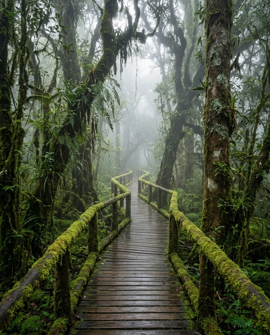
At 2,565 metres above sea level, the summit of Doi Inthanon marks the highest point in Thailand. Rather than an exposed panoramic crag, the apex sits enveloped in a moist, evergreen cloud forest where daily condensation sustains high-altitude peat bogs, sphagnum moss, and tree branches laden with epiphytic ferns and orchids. A short paved path leads to the summit marker and a roadside stupa housing the ashes of King Inthawichayanon, the late nineteenth-century ruler of Chiang Mai whose concern for conserving northern watersheds inspired the national park's creation and modern name.
Directly across the road from the summit car park lies the entrance to the Ang Ka Nature Trail. This 360-metre raised wooden boardwalk loops through Thailand's highest montane peat swamp, allowing visitors to explore the moss-draped forest floor without damaging the waterlogged peat below. Walking the loop takes roughly 20 to 30 minutes at a measured pace. Interpretive signboards along the timber walkway explain the delicate bog hydrology, which relies on cloud mist rather than ground springs. Birdwatchers regularly look for high-elevation specialists here, including the green-tailed sunbird and the ashy-throated warbler.
Temperatures at this elevation remain damp and cool throughout the year, regularly hovering around 10°C to 12°C during the day and plunging near freezing on cool-season mornings, so a warm fleece or windproof jacket is sensible in any season. A basic visitor shelter, toilets, and a small café near the parking turnaround sell hot coffee and tea. For the quietest experience along the boardwalk before day-tour minivans arrive from Chiang Mai, reach the summit car park before 09:00.
The Royal Twin Pagodas of Naphamethinidon and Naphaphonphumisiri
Standing near kilometre marker 41.5 along Highway 1009 at an altitude of roughly 2,140 metres, the Royal Twin Pagodas were built by the Royal Thai Air Force to honour the 60th birthdays of King Bhumibol Adulyadej and Queen Sirikit. The King’s chedi, Phra Mahathat Naphamethinidon—meaning “by the strength of the land and air”—was completed in 1987 with an octagonal profile and a muted brown-grey finish. The Queen’s chedi, Phra Mahathat Naphaphonphumisiri, translated as “being the strength of the air and the grace of the land”, followed in 1992 with a 12-sided design clad in soft lilac and purple mosaic tiling.
Both monuments enshrine sacred Buddha relics beneath pointed spires. Inside their inner chambers, carved stone reliefs illustrate the life of the Buddha, set alongside Buddha statues including a green granite image in the King’s stupa and a white jade sculpture in the Queen’s.
Between the two chedis, landscaped terraced gardens flourish in the cooler sub-alpine air, showcasing temperate flowers such as hydrangeas, pansies, and cabbage roses that cannot survive in the tropical lowlands. Covered escalators carry visitors up the steep hillside terraces toward the chedi platforms, though returning to the entrance level requires negotiating stone stairs. Southern and western parapets look out across steep drops into the Mae Chaem valley, delivering clear sightlines over cloud inversions on calm winter mornings.
Because the site is maintained by the Royal Thai Air Force, visitors pay a separate admission fee of 100 THB (around £2.30) per adult at the pagoda entrance, distinct from the main national park gate.
Chiang Mai presents an earthy, spice-heavy Lanna cuisine, distinct from southern Thai flavors. At Siri-wattana Market, locals eat for under 100 THB, experiencing the region's diverse and authentic tastes.
Kew Mae Pan Nature Trail
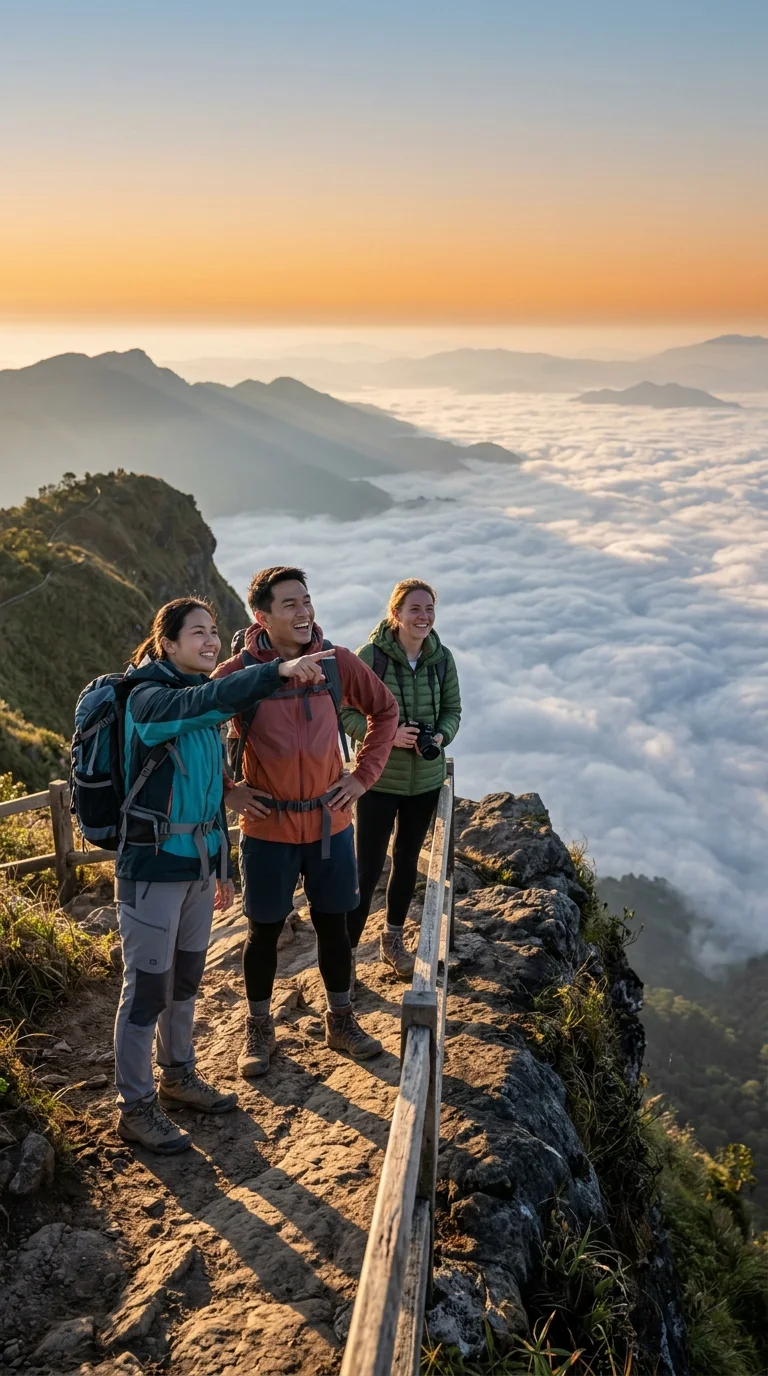
The Kew Mae Pan Nature Trail is a circular walking route situated at kilometre 42 along the summit road, roughly 2,200 metres above sea level. Spanning a 2.8-kilometre loop, the trail opens from 1 November to 31 May, closing between June and October to let subalpine vegetation recover. Park rules require every walking party to hire a local Hmong guide from the neighbouring Ban Khun Klang community. This arrangement costs 200 THB (around £4.60) per group of up to ten people, payable at the trailhead registration desk.
The circuit requires two to three hours to complete and leads past 21 numbered interpretive stations explaining regional ecology. Hikers begin beneath the dense canopy of an evergreen cloud forest rich with mosses, ferns, and mountain streams, before breaking out at station nine onto open subalpine grassland. From here, a wooden boardwalk follows an exposed ridge above the Mae Pan valley. Along the cliff edge, scarlet rhododendrons (Rhododendron delavayi) flower between December and February, framing views across western valleys towards the twin royal pagodas.
This cliff path also passes Pha Ngam Noi, a prominent twin granite rock formation sculpted by wind and rain. Leaving the escarpment, the route loops through bamboo stands and descends back towards the starting area. The high altitude and steep wooden staircases require moderate fitness, though complimentary bamboo walking sticks at the entrance help with stability. While endangered Chinese gorals inhabit the crags below, sightings are rare; hikers more commonly spot Himalayan striped squirrels, minlas, and montane raptors. Arrive before 08:30 on dry-season weekends to avoid queuing at the guide counter.
Major Waterfalls and Aquatic Ecosystems
Doi Inthanon forms a primary catchment basin for tributaries of the Ping River, channelling mountain rainfall into some of northern Thailand's most dramatic cascades. In the southern sector of the park, Mae Ya Waterfall drops roughly 260 to 280 metres across thirty tiers of Carboniferous granite and gneiss, spreading up to 100 metres wide during periods of peak flow.
Along Highway 1009, the main summit road, the cascades vary significantly in scale and accessibility. Near the park entrance at kilometre 8, Mae Klang Waterfall tumbles through multiple rocky tiers flanked by picnic grounds and shaded walkways. Further up at kilometre 21, Wachirathan Waterfall thunders over a 70-to-80-metre precipice into a churning basin. The force of the drop generates continuous spray and cool downdrafts that drift across timber viewing decks, making a waterproof jacket or protective lens cover advisable for photography. Higher still, near kilometre 26, the trail to Pha Dok Siew Waterfall weaves through pine forest and farmland managed by the Karen community of Ban Mae Klang Luang. Here, bamboo aqueducts channel stream water into terraced rice paddies and shade-grown Arabica coffee plots.
Downstream, these upland streams sustain native aquatic fauna and provide irrigation for orchards and crops across the Chom Thong valley.
Accommodation and Park Infrastructure
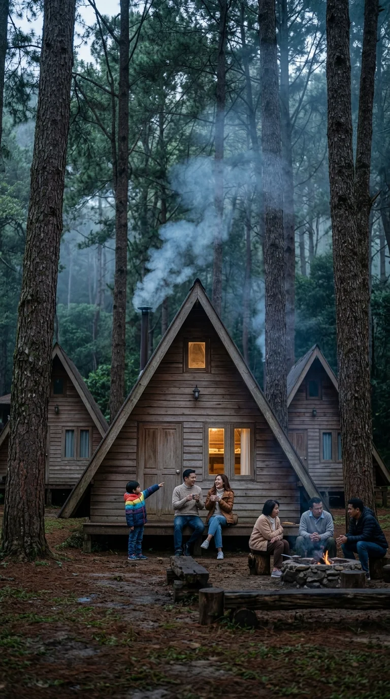
Staying inside Doi Inthanon National Park allows travellers to access high-altitude trails and viewpoints at sunrise before day-tour traffic arrives from Chiang Mai. Overnight accommodation falls into three distinct categories: state-managed forestry chalets and campgrounds operated by the Department of National Parks (DNP), hillside guesthouses on the grounds of the Royal Agricultural Station Inthanon, and community-managed homestays in neighbouring Karen and Hmong villages.
The central administrative hub sits at kilometre 31 on Route 1009, beside the Hmong village of Ban Khun Klang. Here, park headquarters manages a cluster of wooden forestry chalets sleeping between two and eight people. These lodges provide basic mountain comfort, including private bathrooms with hot-water showers, electricity, and firm mattresses. Building insulation is minimal, and indoor temperatures frequently drop into single digits between November and February. About 300 metres away, Dong Son campground provides tent pitches in a pine clearing. Campers with their own gear pay 30 baht per person nightly. Those without equipment can hire two- to three-person tents, sleeping mats, and sleeping bags on site through the park office. Cold-water ablution blocks and phone-charging points serve the campsite.
At Ban Khun Klang, the Royal Agricultural Station Inthanon operates chalets and guesthouse rooms beneath Siriphum Waterfall. Accommodations include en-suite bathrooms, hot showers, and landscaped garden grounds. The station restaurant serves cold-water rainbow trout alongside seasonal strawberries and temperate vegetables grown directly on local terraces.
Down at kilometre 26, the White Karen village of Ban Mae Klang Luang provides community homestays and timber stilt cottages overlooking terraced rice paddies. Villagers roast locally grown Arabica coffee over open fires and host travellers in simple rooms with private bathrooms. In nearby Ban Pha Mon, a community-run bamboo lodge similarly looks out across stepped valley hillsides.
State-run park bungalows can be reserved up to 60 days ahead through the official national park portal. Cabins and homestays fill rapidly on cool-season weekends and Thai public holidays.
| Accommodation Option | Location | Capacity | Standard Facilities | Starting Price (THB) | Starting Price (GBP approx) |
|---|---|---|---|---|---|
| DNP Forestry Chalet (Small) | Headquarter Zone (KM 31) | 2–3 guests | Hot shower, fan, private balcony | 1,000 | £23.50 |
| DNP Forestry Bungalow (Family) | Dong Son Zone (KM 31) | 6–8 guests | Multiple bedrooms, hot water, kettle | 3,000 | £70.50 |
| Official Park Camp Pitch | Dong Son Campground | 2–3 per tent | Shared ablutions, tent hire available | 250 | £5.90 |
| Royal Project Guesthouse | Agricultural Station | 2 guests | En-suite bathroom, hot shower, breakfast | 2,200 | £51.70 |
| Karen Village Homestay | Ban Mae Klang Luang | 2–4 guests | Private bathroom, valley deck, local coffee | 1,200 | £28.20 |
Location and Getting There
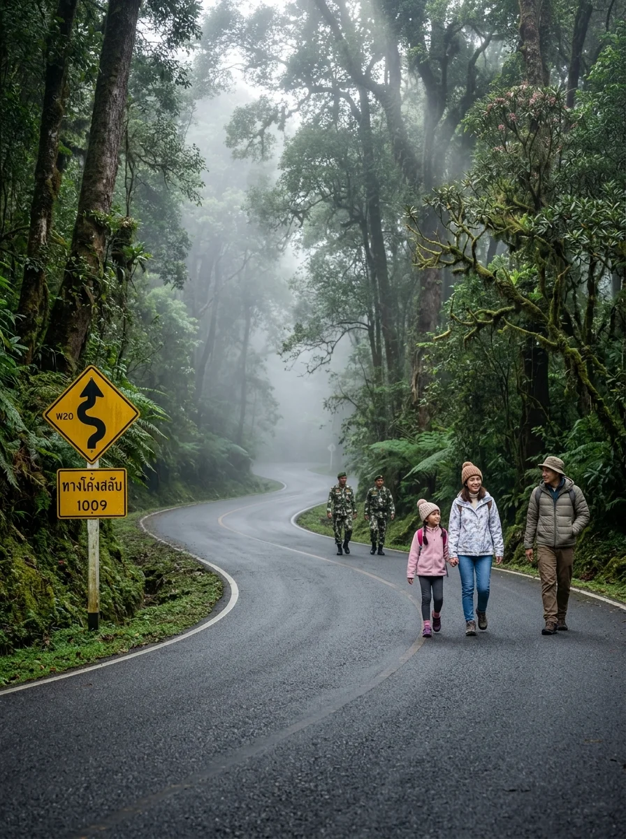
Doi Inthanon National Park lies across the Chom Thong and Mae Chaem districts of Chiang Mai Province. The lower checkpoint at the park entrance sits roughly 70 kilometres southwest of Chiang Mai Old Town, while reaching the 2,565-metre summit entails a journey of around 106 kilometres. Motorists take Highway 108 south through San Pa Tong towards Chom Thong, before turning right onto Highway 1009, the winding mountain spine road that climbs all the way through the park.
Driving directly from central Chiang Mai takes roughly 90 minutes to the lower gate and two to two and a half hours to reach the summit. Hiring a private car or chauffeured SUV for a full-day return trip generally costs between 2,500 THB and 3,500 THB (£59 to £82), which typically covers fuel, driver waiting time, and transport between viewpoints.
Public transport is possible but requires a transfer. Yellow songthaews (shared pick-up trucks) depart regularly from Pratu Chiang Mai (the south gate) to Chom Thong for 40 THB (£0.95), stopping near Wat Phra That Si Chom Thong. From there, travellers must negotiate a charter songthaew up the mountain, which generally costs between 1,500 THB and 2,000 THB (£35 to £47) round-trip. Hiring a small automatic scooter is ill-advised for inexperienced riders: Highway 1009 features sharp switchbacks, sustained steep gradients, and slick alpine mist that readily overwhelms small engines and brakes.
Costs and Booking
Admission to Doi Inthanon National Park is charged under standard Department of National Parks (DNP) tariffs. At the time of research, foreign adult tickets cost 300 THB (approximately £7.05) and foreign children aged 3 to 14 cost 150 THB (£3.50), while children under three enter free of charge. Vehicle fees are levied separately at 30 THB (£0.70) for a car and 20 THB (£0.47) for a motorcycle.
Tickets are valid for one calendar day across all park-managed sites, including Wachirathan, Mae Ya, and the summit boardwalk. Entrance fees must be paid in Thai baht cash; electronic cards and international digital payments are not accepted at the booths. Visitors arriving from Chiang Mai along Highway 1009 buy tickets at Checkpoint 1 (KM 8), whereas traffic from Mae Chaem pays at Checkpoint 2 (KM 38). Keep the paper receipt carefully, as rangers check it at Checkpoint 2 before permitting vehicles to ascend the upper mountain.
Park entry tariffs do not fluctuate by season. However, specific attractions incur separate costs. The Royal Twin Pagodas charge an independent admission of 100 THB (£2.35), administered by the Royal Thai Air Force. Trekking the Kew Mae Pan trail requires engaging a local Hmong guide at the trailhead for a mandatory fee of 200 THB (£4.70) per group. While daytime entry requires no advance booking, park chalets and campsite pitches fill rapidly during the cool November-to-February peak and require booking ahead.
| Option | Cost (THB per night) | Cost (GBP approx) | Notes |
|---|---|---|---|
| Park Entry (Foreign Adult) | 300 | £7.05 | Valid for one day across main park sites |
| Park Entry (Foreign Child) | 150 | £3.50 | Ages 3 to 14 |
| Vehicle Entry Fee (Car) | 30 | £0.70 | Paid once at entrance checkpoint |
| Kew Mae Pan Guide Fee | 200 | £4.70 | Per party, paid directly to local Hmong guide |
| Twin Pagodas Admission | 100 | £2.35 | Administered by Royal Thai Air Force |
| Camping Pitch (Own Gear) | 30 | £0.70 | Per person per night at official sites |
Who It Suits
Doi Inthanon suits independent motorists, keen walkers, landscape photographers, and birdwatchers drawn to montane cloud forests and cool upland weather. With well over 300 recorded bird species and varied elevation zones, the park draws wildlife enthusiasts throughout the dry months. Families comfortable with moderate walking will find the paved main highway and wooden boardwalks straightforward to navigate, providing direct access to waterfalls and mossy peat bogs without requiring wilderness trekking experience.
Conversely, the destination does not suit travellers seeking warm tropical sunshine, resort-style swimming pools, or evening nightlife. At higher elevations, temperatures feel chilly year-round and can drop towards freezing between November and February. Remote workers requiring reliable high-speed internet and visitors without hired transport will also struggle, as mobile connectivity is patchy across the valleys and no scheduled internal transit links the dispersed viewpoints.
What to Know Before You Book
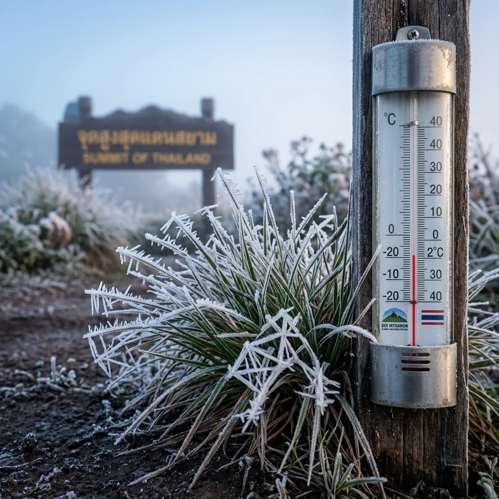
Morning temperatures at the 2,565-metre summit routinely plunge towards freezing between December and January, with frost frequently dusting the boardwalks and grassy banks. Packing substantial warm layers, including a fleece, hat, and windproof jacket, is necessary for early departures, as lightweight tropical holiday clothing will prove completely inadequate on the upper peaks.
The celebrated Kew Mae Pan ridge trail closes annually from 1 June to 31 October to allow the forest ecosystem to regenerate through the monsoon. If completing this panoramic cliff-edge walk forms the core reason for your visit, arrange your travel between 1 November and 31 May, when dry-season conditions keep the route accessible.
Public transport does not run between the individual sights dotted along the 48-kilometre mountain road (Highway 1009). Although shared songthaews serve local villages, they do not function as a hop-on shuttle between waterfalls, viewpoints, and trailheads. Arranging a private driver, reserving a guided vehicle excursion, or hiring a capable car from Chiang Mai is practical necessity before setting out.
Entry checkpoints, pagoda ticket desks, tribal hiking guides, and roadside fruit stalls operate on cash, with foreign credit cards unaccepted across the reserve. Mobile banking apps are widely restricted to domestic accounts, and the sparse cash machines near park headquarters at Ban Khun Klang suffer frequent connectivity outages. Withdraw ample Thai baht in Chiang Mai or Chom Thong town before ascending the mountain.
Practical Tips
Setting out from Chiang Mai before 06:00 is recommended for a day visit to Doi Inthanon National Park. Leaving early ensures you complete the two-hour drive and reach the upper car parks before tour coaches arrive around 09:30. An early start also provides the greatest likelihood of catching clear morning views and cloud inversions rolling across the valleys.
Pack warm clothing layers, regardless of the forecast in the lowlands. Due to the high altitude and dense canopy shade, summit temperatures are regularly 10 to 15 degrees Celsius lower than in Chiang Mai city, dropping near freezing on winter mornings between November and February. A windproof outer shell over a fleece or insulating mid-layer prevents uncomfortable shivering along exposed trails.
Exercise caution when driving down Highway 1009. The sustained descent from the summit features steep gradients that quickly overheat vehicle brakes. Shift into lower gears to utilise engine braking rather than riding the foot brake continuously. Motorcyclists and scooter riders should pull over periodically at designated turn-outs to let their brakes cool.
Keep your passport or a clear photograph of the photo page accessible on your phone. Park staff at Checkpoint 1 register foreign visitors under Department of National Parks procedures, and having identification ready speeds up ticket processing. Retain your physical paper ticket throughout the day, as rangers inspect it again at higher checkpoints and waterfall turn-offs.
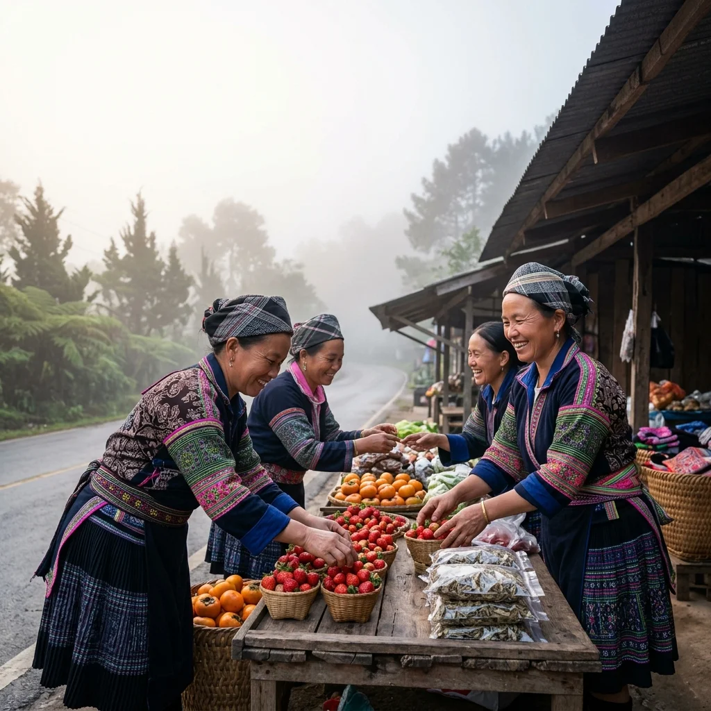
Make time to stop at the roadside Hmong market near the park headquarters at kilometre 31. Stalls sell seasonal strawberries, dried persimmons, macadamia nuts, and Arabica coffee beans grown through Royal Project agricultural initiatives. Nearby, the Royal Agricultural Station Inthanon restaurant prepares fresh cold-water rainbow trout and sturgeon alongside organic highland greens picked from local research plots.
If you prefer not to negotiate the steep mountain road independently, organising a private driver or guided day tour provides a straightforward way to explore the national park.
Quick Reference Table
| Item | Detail | Notes |
|---|---|---|
| Summit elevation | 2,565 metres | Highest point in Thailand; evergreen montane cloud forest |
| Park entry (foreign adult) | 300 THB (£7.05) | Cash only; covers all park-managed sites for one calendar day |
| Park entry (foreign child) | 150 THB (£3.50) | Ages 3 to 14; children under 3 enter free of charge |
| Vehicle entry fee | 30 THB (car) / 20 THB (motorcycle) | Paid once at entrance checkpoint |
| Kew Mae Pan trail season | 1 November to 31 May | Closed June to October annually for vegetation recovery |
| Kew Mae Pan guide fee | 200 THB (£4.70) per party | Mandatory local Hmong guide for groups up to 10 hikers |
| Royal Twin Pagodas admission | 100 THB (£2.35) per adult | Separate fee administered by the Royal Thai Air Force |
| Private day-hire transport | 2,500–3,500 THB (£59–£82) | Chauffeured car or SUV return from central Chiang Mai |
| Recommended arrival time | Before 09:00 at summit | Beats tour minivans and catches early cloud inversions |
| Forestry chalet booking window | Up to 60 days in advance | Via official DNP portal; chalets cost 1,000–3,000 THB nightly |
| Website | https://portal.dnp.go.th | Department of National Parks official portal |
| Book direct | https://nps.dnp.go.th | Official DNP national park accommodation booking portal |
FAQ: Doi Inthanon National Park
What is Doi Inthanon National Park known for?
What clothing should visitors wear at the Doi Inthanon summit?
What is the best time to visit the Ang Ka Nature Trail for a quiet experience?
Is there a separate entrance fee for the Royal Twin Pagodas at Doi Inthanon?
When is the Kew Mae Pan Nature Trail open for visitors?
Do visitors need a guide to hike the Kew Mae Pan Nature Trail?
What should photographers bring when visiting Wachirathan Waterfall?
What types of accommodation are available inside Doi Inthanon National Park?
Is it safe to ride a small automatic scooter to Doi Inthanon National Park?
What payment methods are accepted for admission to Doi Inthanon National Park?
Reviewed by the Thailand Guide Editorial Team • Last reviewed: 27 September 2026
This page is provided for general information only. While we aim for accuracy, details can change — please verify anything important independently before relying on it.