Chao Phraya River
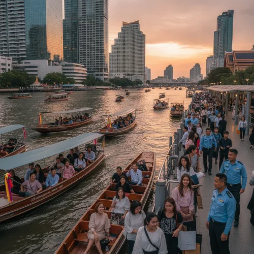
Formed by the confluence of the Ping and Nan rivers in Nakhon Sawan, the Chao Phraya River flows 372 kilometres south through Thailand's central plains into the Gulf of Thailand. As central Thailand's primary waterway, it functions as a major transport artery through Bangkok, carrying tens of thousands of daily commuters alongside tourist vessels and traditional long-tail boats.
The river passes through ten provinces—including the historic royal capital of Ayutthaya—before flowing through Bangkok and discharging into the sea at Samut Prakan. Water levels, navigation, and flood defences are managed primarily by Thailand's Marine Department and the Royal Irrigation Department. Within Bangkok, the watercourse separates the historic eastern districts from Thonburi on the west bank. For visitors and residents alike, scheduled river ferries provide direct access to key riverside temples and cultural landmarks while bypassing the capital's congested road network.

Geographic Course and Central Plain Basin
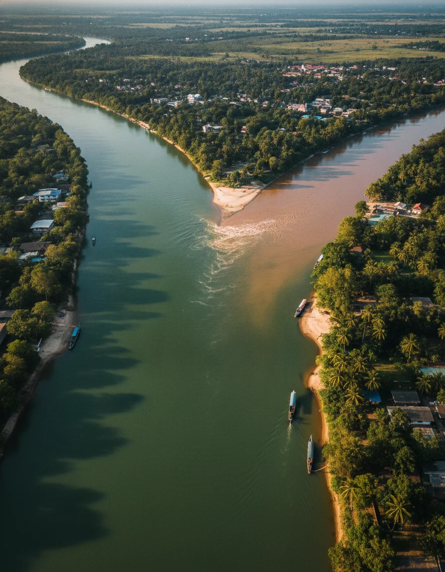
The Chao Phraya River forms the central hydrological artery of Thailand, flowing approximately 372 kilometres from the northern central plains to the Gulf of Thailand. Its main stem officially begins at Pak Nam Pho in Nakhon Sawan province, where the southward-flowing Ping and Nan river systems converge. From this confluence, the river winds through flat, fertile agricultural terrain, descending less than 25 metres in elevation across its entire journey to the sea.
Flowing south from Nakhon Sawan, the waterway traverses ten provinces in succession: Uthai Thani, Chai Nat, Sing Buri, Ang Thong, Phra Nakhon Si Ayutthaya, Pathum Thani, Nonthaburi, Bangkok, and Samut Prakan. In Chai Nat, the Chao Phraya Dam acts as a major diversion structure, regulating seasonal discharge and channelling water into extensive irrigation networks and western distributaries, most notably the Tha Chin River. Further downstream at Ayutthaya, the river meets the Pa Sak and Lopburi rivers, encircling the historic island capital before widening into a deep, navigable shipping corridor through Greater Bangkok. At Samut Prakan, the river broadens through mangrove wetlands and deep-water container terminals before discharging into the Gulf of Thailand.
Understanding this geography helps when planning journeys along the river basin. While the upper and middle reaches support freshwater fishing, paddy irrigation, and provincial car ferries, the lower river functions as a heavily trafficked maritime thoroughfare supporting cargo barges, water taxis, and commuter boats.
| Basin Section | Provinces Traversed | Key Geographic & Cultural Features | Primary Transit & River Access |
|---|---|---|---|
| Upper River Basin | Nakhon Sawan, Uthai Thani, Chai Nat | Ping-Nan confluence at Pak Nam Pho, Chao Phraya Dam, freshwater fisheries | Local road bridges and regional river landings |
| Central Heartland | Sing Buri, Ang Thong, Ayutthaya | Historic island city loop, riverside temples, agricultural canal network | Long-tail boat charters and provincial car ferries |
| Lower Urban Corridor | Nonthaburi, Bangkok, Samut Prakan | Dense urban waterfront, commercial shipping facilities, Gulf of Thailand estuary | Express boat network and cross-river passenger ferries |
Travellers exploring the river corridor can arrange organised boat excursions, private river transfers, and regional sightseeing tickets along the navigable urban and historical waterways.
Bangkok Public River Transit and Express Boat Services
Bangkok’s scheduled river boats provide a fast, practical transit network that bypasses the capital’s heavy road congestion. The primary operator, the Chao Phraya Express Boat Company, runs passenger services along a numbered pier system covering both banks. Vessels display colour-coded flags to indicate their route, stopping pattern, and operating timetable.
The most practical option for general sightseeing is the Orange Flag boat. Operating daily between Nonthaburi Pier (N30) in the north and Wat Rajsingkorn Pier (S3) in the south, it calls at major piers including Sathorn, Tha Tien, and Tha Chang for a flat fare of 18 THB (around £0.40). In contrast, the Yellow and Green-Yellow flag services cater specifically to weekday rush-hour commuters, running express routes that link northern residential areas with Sathorn while skipping quieter intermediate landings.
Modern electric catamarans operated under the Thai Smile Boat network (formerly Mine Smart Ferry) provide fully enclosed, air-conditioned alternatives along parallel routes, with single journeys typically priced at 30 THB (£0.66). For short hops directly across the river, dedicated cross-river shuttle ferries run continuously between opposing piers—such as the crossing from Tha Tien to Wat Arun—charging around 5 to 5.50 THB (£0.12). Using these scheduled water services offers predictable journey times between downtown transit hubs and historic riverside districts.
Plan a Northern Thailand trip covering Chiang Mai, Chiang Rai, Sukhothai, mountain routes, Lanna food, transport, seasons and air quality.
Excursions, Long-Tail Charters, and Dinner Cruises
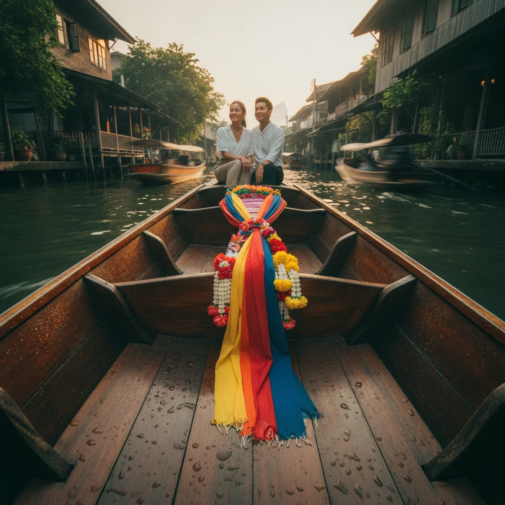
Beyond scheduled commuter ferries, private wooden long-tail boats and evening dining vessels provide dedicated leisure transport along Bangkok's waterways. Long-tail boats can be chartered directly from official counters at major landings, including Sathorn Pier, Tha Chang Pier, Tha Tien Pier, and River City. Powered by automotive engines mounted on extended propeller shafts, these craft navigate the historic khlong (canal) network of Thonburi on the river's western bank. Routes through Khlong Bangkok Yai and Khlong Mon pass traditional wooden stilt houses, waterfront temples, and local canal communities that public commuter ferries cannot reach.
In the evening, commercial dinner cruises operate round trips along the illuminated river corridor, typically travelling between southern piers and the Rama VIII Bridge. Vessels range from large multi-deck craft with international buffet dining and live music to restored teak rice barges serving multi-course Thai set meals in smaller dining settings. Most dinner cruises depart nightly between 19:00 and 20:00, with journeys lasting roughly two hours. Key boarding hubs include ICONSIAM, Asiatique The Riverfront, and River City Bangkok. Because departure piers vary by operator and check-in counters generally open 30 to 45 minutes prior to sailing, verifying the allocated terminal beforehand prevents missed departures.
Riverside Heritage and Architectural Landmarks
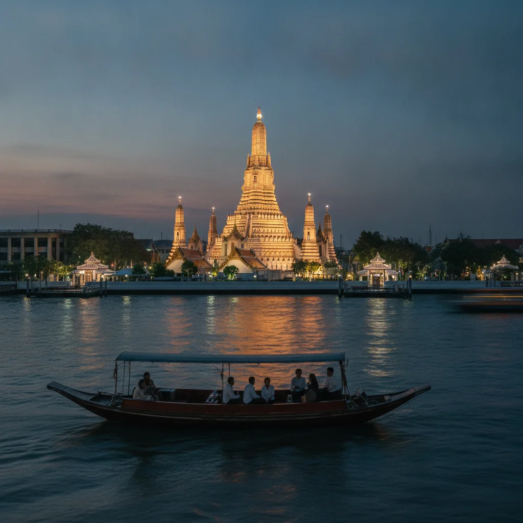
The Chao Phraya riverfront contains many of Bangkok's key historical, religious, and modern commercial landmarks. Concentrated along both banks, these sites reflect the capital's evolution from the 18th-century Thonburi era through the Rattanakosin period to modern retail developments. Because most major attractions sit directly beside the water, river ferries provide direct access without the delays of inner-city road congestion.
On the eastern bank in the historic Phra Nakhon district, the Grand Palace complex and Wat Phra Kaew (Temple of the Emerald Buddha) stand a short walk from Tha Chang Pier (N9). Just south, Wat Pho—famed for its 46-metre reclining Buddha—borders Tha Tien Pier (N8). Directly across the river on the western bank in Thonburi rises Wat Arun (Temple of Dawn), known for its Khmer-style central spire (prang) rising over 70 metres and decorated with intricate motifs made from recycled Chinese porcelain.
Further downriver on the western bank lies the Kudi Chin neighbourhood, where the neoclassical Santa Cruz Church and the towering seated Buddha of Wat Kalayanamit illustrate the Portuguese, Chinese, and Siamese communities that settled here under King Taksin. Modern commercial ventures occupy prominent riverfront positions downstream. These include IconSiam, featuring a broad multi-level public riverside terrace on the Thonburi side, and Asiatique The Riverfront, an open-air retail complex built around the restored trading docks and warehouses of the former Danish East Asiatic Company.
Water Quality, Safety, and Seasonal Hydrology
The lower Chao Phraya is a working commercial waterway carrying substantial urban runoff, agricultural drainage, industrial discharge, and suspended silt. High bacterial counts and heavy vessel traffic mean the water is unsuitable for swimming, wading, or paddle sports. Travellers should treat the river as a transport and sightseeing corridor, avoiding direct contact with the water.
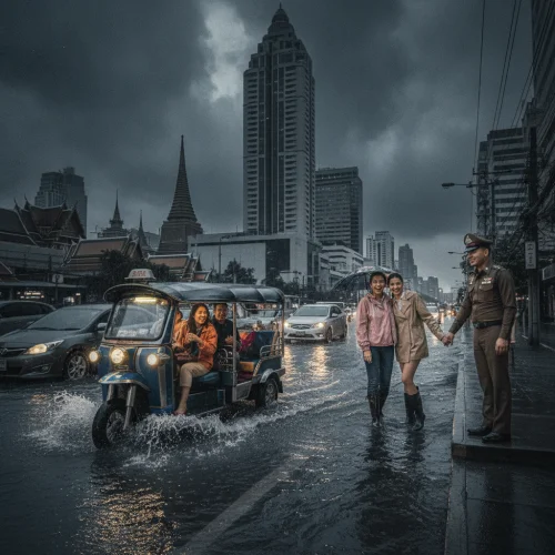
Hydrological conditions shift significantly towards the end of the monsoon season, particularly from September through November. During this period, heavy upstream discharge channelled down from northern Thailand converges with seasonal high tides pushing inland from the Gulf of Thailand. This combination routinely raises water levels along low-lying riverbanks in Ayutthaya, Nonthaburi, and Bangkok.
Municipal authorities and riverside establishments regularly deploy sandbag barriers and temporary floodwalls to protect piers and promenades from tidal overflow. Faster river currents during these peak discharge months also increase pontoon sway, requiring extra care when stepping across boarding gangways. Those visiting during late autumn should monitor local water-level alerts and expect occasional high-tide disruption at low-lying river landings.
Navigating the Chao Phraya River Corridor
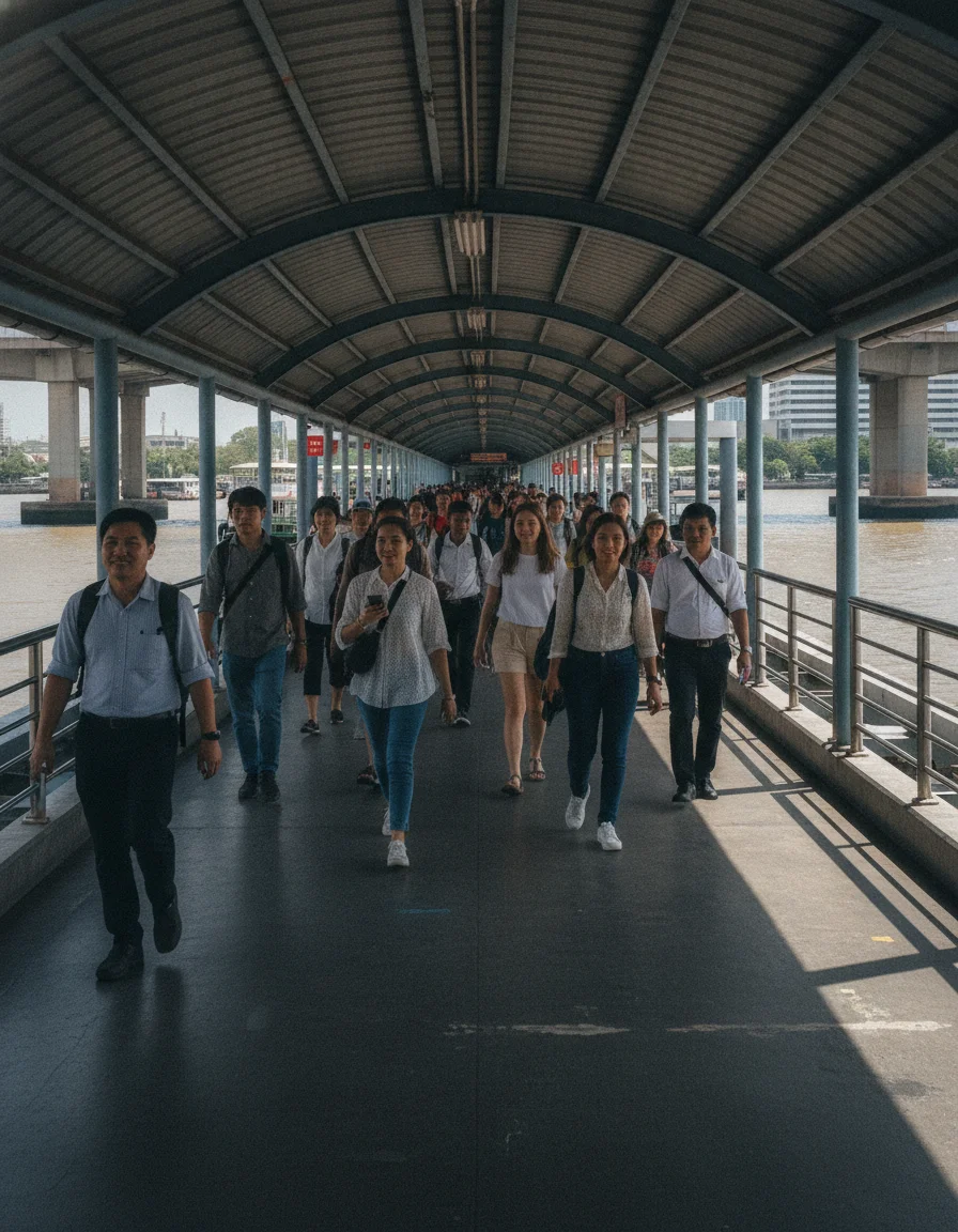
The Chao Phraya River flows through central Bangkok, separating the historic east bank from the Thonburi west bank. Reaching the riverfront from Bangkok's international airports and downtown commercial districts is straightforward using the city's elevated and underground rail networks.
Saphan Taksin BTS Station on the Silom Line is the primary gateway to the river. Exit 2 connects directly via stairs and a covered walkway to Sathorn Pier (also known as Central Pier), where express commuter boats, tourist vessels, and hotel shuttle barges dock. Travellers arriving at Suvarnabhumi Airport (BKK) can board the Airport Rail Link to Phaya Thai, switch to the BTS Sukhumvit Line as far as Siam, and transfer across the platform to the Silom Line for Saphan Taksin. The full rail trip takes roughly 50 to 60 minutes and costs around 92 THB (approximately £2.00).
From Don Mueang Airport (DMK), passengers can take the SRT Dark Red Line to Krung Thep Aphiwat Central Terminal (Bang Sue), then transfer to the MRT Blue Line underground network. The MRT Blue Line provides direct river access at Sanam Chai station for the historic Rattanakosin district and Rajinee Pier, or at Bang Pho station in the north. Metered taxis from downtown Sukhumvit to Sathorn Pier typically cost between 100 THB and 180 THB (£2.20 to £3.90), though severe traffic during peak morning and evening rush hours makes the rail network far more predictable.
Fares, Cruise Pricing, and Ticket Options
Fares on the Chao Phraya River provide exceptional value compared to European transit systems. Standard commuter services operated by the Chao Phraya Express Boat charge fixed single fares depending on the route. The regular Orange Flag service costs 16 to 18 THB (around £0.35 to £0.40) for a flat single journey between any two operational piers. Commuter express routes operating during weekday peak periods, such as the Yellow Flag and Green-Yellow lines, cost between 16 and 35 THB (£0.35 to £0.77) based on distance, while air-conditioned Red Flag catamarans charge a flat 32 to 33 THB (£0.70 to £0.73). Local cross-river ferries connecting opposite banks cost 5 THB (around £0.11) per crossing.
Sightseeing services and modern electric craft operate on separate set tariffs. The Chao Phraya Tourist Boat (Blue Flag) charges 30 THB (£0.66) for individual hops or 150 THB (£3.30) for an unlimited one-day hop-on hop-off pass covering major riverside landmark piers. Air-conditioned MINE Smart Ferry electric catamarans charge a flat single fare of 30 THB (£0.66).
Private charters and evening dining vessels occupy a higher price bracket. Private long-tail boats chartered at official pier counters generally cost between 1,000 THB and 1,500 THB (£22 to £33) per hour for the entire craft, accommodating small groups. Evening dinner cruises range from 1,200 to 1,800 THB (£26 to £40) per person for large multi-deck buffet vessels, rising to 2,200 to 2,800 THB (£48 to £62) per person for multi-course meals aboard converted heritage teak rice barges. Commuter boat tickets are bought at pier kiosks or on board with cash, whereas dinner cruises require advance online booking.
| Service | Fare (THB) | Fare (GBP) | Details |
|---|---|---|---|
| Cross-River Ferry | 5 THB | £0.11 | Single bank-to-bank crossing |
| Orange Flag Express Boat | 16 – 18 THB | £0.35 – £0.40 | Flat single fare covering all regular piers |
| Blue Flag Tourist Boat Day Pass | 150 THB | £3.30 | Unlimited hop-on hop-off travel between landmark piers |
| Private Long-Tail Boat Charter | 1,000 – 1,500 THB per hour | £22.00 – £33.00 | Rate per boat for up to 8 passengers |
| Standard Dinner Cruise | 1,200 – 1,800 THB | £26.00 – £40.00 | Buffet dinner and two-hour scenic evening circuit |
| Teak Rice Barge Dining Cruise | 2,200 – 2,800 THB | £48.00 – £62.00 | Multi-course set menu on restored heritage craft |
Who Should Experience the Chao Phraya River
Bangkok’s river transport suits independent travellers, culture enthusiasts, and families aiming to reach riverside historical landmarks like the Grand Palace and Wat Arun without facing road traffic gridlock. Open-air public express boats provide photographers and budget-conscious visitors with sweeping waterfront views across the capital.
The river is a working urban waterway, making it unsuitable for recreational swimming or watersports. Boarding involves stepping across shifting pontoon docks, and standard diesel-powered express ferries generate engine noise, fumes, and crowded cabins during morning and late afternoon commuter rushes. Travellers with reduced mobility, sensitivity to motion, or an aversion to dense crowds may find air-conditioned MRT underground trains, the BTS Skytrain, or metered taxis more comfortable.
Key Considerations Before Planning Your River Journey
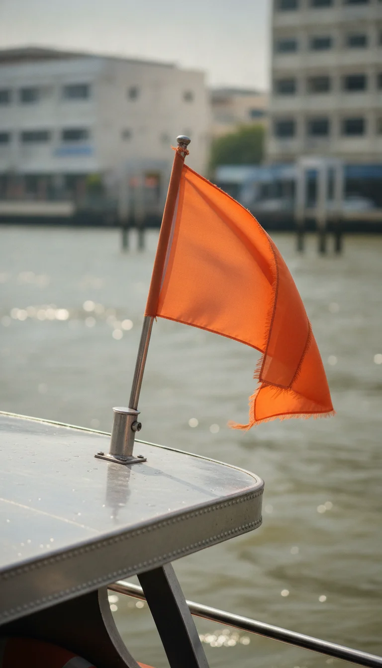
Check the flag colour flown at the stern of incoming express boats before stepping aboard. Flag colours correspond to specific stopping patterns along the Chao Phraya, and boarding an express service that bypasses smaller stops can take you past your destination.
Cross-river ferries and length-of-river express boats use separate boarding slips and ticketing systems, even when sharing the same named stop. Cross-river fares are paid at small turnstiles or coin booths beside the crossing slip, completely separate from the ticket counters for long-distance commuter services.
Weekday peak commuter windows from 07:00 to 09:00 and 16:30 to 18:30 bring packed vessels and long queues at transport hubs such as Sathorn Pier. Travelling between mid-morning and early afternoon provides a more comfortable trip, with shorter queues and available seating.
Between September and November, seasonal runoff combines with Gulf of Thailand high tides to raise river levels. This occasionally submerges low-lying pier walkways and pontoon ramps during tidal peaks. Consult local transit announcements or ferry operator updates during late monsoon periods to verify daily pier operations before setting out.
Practical Advice for River Visitors
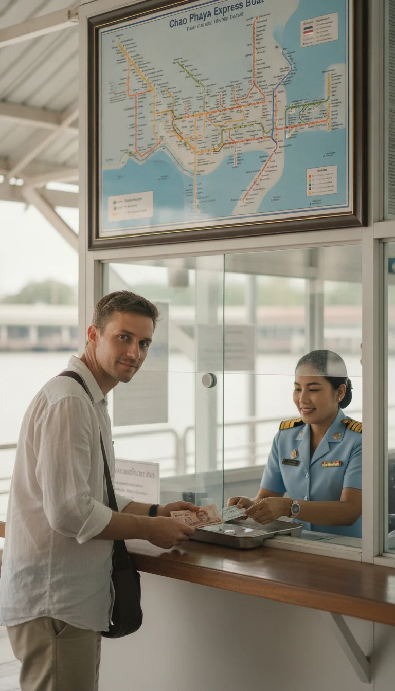
Carry small change and low-denomination banknotes such as 20, 50, and 100 THB notes when purchasing tickets at pier counters. Ticket sellers frequently struggle to change 1,000 THB notes for single public ferry fares, which cost around 16 THB on standard express services. Keep paper ticket stubs accessible until clearing the exit gate at your destination, as conductors inspect tickets during the journey and staff occasionally verify fares on arrival.
Pay close attention to footing when moving across metal gangways onto floating pontoon piers. Wakes and river swells from passing tugboats or commuter catamarans cause floating platforms to shift unexpectedly. Step firmly onto the dock and board vessels promptly once deckhands secure the mooring ropes.
For passengers seeking dedicated English-language announcements and assistance, the Blue Flag Chao Phraya Tourist Boat provides a structured sightseeing route. While pricier than standard commuter routes, it features multi-lingual staff and spacious open decks, though seats remain unreserved and fill quickly during busy afternoon hours.
When booking private long-tail boats for canal exploration, negotiate terms at the official pier ticketing counter rather than engaging independent touts along the promenade. Confirm the route duration, specific canal stops, and total price before boarding. On board, choose seating towards the front or middle of the vessel, as sitting near the open rear exposes passengers to loud modified automotive engines and exhaust fumes.
Travellers heading to major commercial destinations can also use dedicated riverside shuttle services. Sathorn Pier provides direct connections, including a free evening shuttle boat to Asiatique The Riverfront and a low-cost crossing to ICONSIAM.
Quick Reference Table
| Item | Detail | Notes |
|---|---|---|
| Total River Length | 372 kilometres | Flows from Nakhon Sawan to the Gulf of Thailand |
| Total Elevation Drop | Less than 25 metres | Across its entire course from source to sea |
| Provinces Traversed | 10 provinces | Nakhon Sawan, Uthai Thani, Chai Nat, Sing Buri, Ang Thong, Ayutthaya, Pathum Thani, Nonthaburi, Bangkok, and Samut Prakan |
| Origin Confluence | Pak Nam Pho, Nakhon Sawan | Meeting point of the southward-flowing Ping and Nan rivers |
| Primary Bangkok Transit Hub | Sathorn Pier (Central Pier) | Direct covered walkway connection to Saphan Taksin BTS Station (Exit 2) |
| Cross-River Shuttle Ferry Fare | 5 – 5.50 THB (£0.11 – £0.12) | Per single crossing between opposing piers |
| Orange Flag Express Boat Fare | 16 – 18 THB (£0.35 – £0.40) | Flat single fare operating daily between Nonthaburi and Wat Rajsingkorn |
| Commuter Express Routes (Yellow / Green-Yellow) | 16 – 35 THB (£0.35 – £0.77) | Distance-based fares operating during weekday peak rush hours |
| Electric Catamaran (MINE Smart / Thai Smile Boat) | 30 THB (£0.66) | Flat single fare for air-conditioned scheduled services |
| Blue Flag Tourist Boat | 30 THB (£0.66) single / 150 THB (£3.30) day pass | Hop-on hop-off service calling at key riverside landmark piers |
| Private Long-Tail Boat Charter | 1,000 – 1,500 THB (£22.00 – £33.00) per hour | Official pier counter rate per vessel (accommodates up to 8 passengers) |
| Buffet Dinner Cruise | 1,200 – 1,800 THB (£26.00 – £40.00) per person | Typical two-hour evening scenic circuit with international buffet |
| Heritage Teak Rice Barge Cruise | 2,200 – 2,800 THB (£48.00 – £62.00) per person | Evening scenic dining with multi-course Thai set menu |
| Airport Rail Transfer (BKK to River) | 50 – 60 minutes (approx. 92 THB / £2.00) | Airport Rail Link to Phaya Thai, transferring via BTS to Saphan Taksin |
| Peak Commuter Windows | 07:00 – 09:00 and 16:30 – 18:30 | Weekdays; boats and transport piers experience heavy passenger volumes |
| High Water & Tidal Swell Period | September to November | Monsoon runoff and seasonal sea tides elevate river levels |
FAQ: Chao Phraya River
Why should I use river ferries on the Chao Phraya River in Bangkok?
Where does the Chao Phraya River originate and how long is it?
How can I identify different Chao Phraya Express Boat routes?
Which Chao Phraya Express Boat route is best for sightseeing in Bangkok?
How do I cross the Chao Phraya River for short distances?
What can I experience on a private long-tail boat tour in Bangkok?
What are the typical timings and boarding locations for Chao Phraya River dinner cruises?
What major landmarks can be accessed from the Chao Phraya River?
Is the Chao Phraya River safe for swimming or water sports?
When are high water levels expected on the Chao Phraya River?
Reviewed by the Thailand Guide Editorial Team • Last reviewed: 27 August 2026
This page is provided for general information only. While we aim for accuracy, details can change — please verify anything important independently before relying on it.