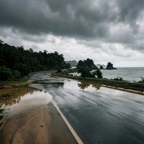
Severe rainfall and strong thundershowers are forecast across southern and upper Thailand following the arrival of a cold air mass from China, the Thai Meteorological Department confirmed on 25 October 2026.
The unsettled weather will persist over the next 24 hours. A high-pressure system extending over upper Thailand and the South China Sea is interacting with moisture-laden easterly winds and an intensifying southern monsoon trough. The meteorological agency has warned that this combination will generate sudden downpours, lightning, and strong gusts across multiple provinces. For British nationals living in the country or planning regional travel, the conditions present practical risks involving localised flooding, transport disruption, and maritime restrictions.
Overview of the Weather System
The weather front is moving progressively through the country. The North and North-East are experiencing the initial effects, which are now extending into Central Thailand, Bangkok, and the Eastern Seaboard.
Rainfall will be heaviest in the southern provinces. In these areas, continuous downpours create high risks of flash floods and surface run-off. Residents living near foothill slopes, natural waterways, and low-lying coastal plains must prepare for rapid water accumulation. In northern and central regions, the primary hazards are squalls, falling branches, and unstable street signage.
Southern Thailand and Maritime Operations
Southern Thailand faces the most severe weather over the forecast period. On the west coast, including the expat centres of Phuket, Krabi, and Phang Nga, thundershowers are expected to cover roughly 70 per cent of the area.
Ranong, Trang, and Satun will also see very heavy downpours. Day temperatures will reach highs between 31°C and 33°C, falling to overnight lows of 23°C to 26°C. Winds from the north-west are blowing at speeds between 15 and 30 km/h.
On the eastern coast of the peninsula, rain will affect roughly 60 per cent of the region. Surat Thani—including the islands of Koh Samui, Koh Phangan, and Koh Tao—will experience heavy precipitation alongside Nakhon Si Thammarat and Phatthalung. Further south, Songkhla, Pattani, Yala, and Narathiwat face very heavy rainfall. Winds remain variable at 15 to 30 km/h, with maximum daytime temperatures ranging between 32°C and 35°C.
Sea conditions are rough. Wave heights in both the Gulf of Thailand and the Andaman Sea average one metre during calm intervals but exceed two metres during thundershowers. Marine authorities have advised all vessel operators to exercise extreme caution. British residents relying on inter-island ferry services or operating private recreational craft should anticipate route delays, timetable cancellations, and temporary harbour closures until conditions stabilise.
Bangkok and the Central Region
The capital and its neighbouring provinces will see thundershowers covering approximately 20 per cent of the metropolitan area. Daytime temperatures will remain high, peaking between 34°C and 35°C, with night-time minimums settling between 25°C and 27°C. Southeasterly winds are blowing at 10 to 20 km/h.
In the broader Central region, rain will also cover 20 per cent of the area. The precipitation is concentrated largely in Kanchanaburi, Ratchaburi, Nakhon Pathom, Samut Sakhon, and Samut Songkhram. Temperatures across these provinces will reach up to 36°C.
While the coverage in Bangkok is lower than in the south, short bursts of intense rain can quickly overwhelm city drainage systems. Low-lying streets and side roads often collect standing water within minutes. British expatriates commuting through the capital should expect extended journey times on major arterial routes, particularly during the evening rush hour.
Northern and North-Eastern Provinces
In the North, thundershowers will cover 30 per cent of the region. The unsettled conditions are centred on Phayao, Nan, Phrae, Uttaradit, Phitsanulok, and Phetchabun.
Gusty winds will accompany the rain in several districts. Maximum temperatures will reach 35°C to 37°C, while minimum temperatures will drop to between 21°C and 26°C, marking the onset of cooler seasonal air. Southeasterly winds are recorded at 10 to 20 km/h.
The North-East will see similar conditions across 30 per cent of its territory. Heavy rain and strong winds are forecast for Loei, Nong Khai, Bueng Kan, Udon Thani, Sakon Nakhon, and Nakhon Phanom. Daytime highs will reach 34°C to 37°C, with easterly winds blowing at 10 to 20 km/h. Expats travelling on regional highways across rural areas should remain cautious of sudden crosswinds, reduced visibility, and debris on unlit stretches of road.
Eastern Seaboard and Coastal Environs
The Eastern region will experience thundershowers across 20 per cent of the area. The weather will affect Nakhon Nayok, Chachoengsao, and the major residential zones of Chonburi and Rayong.
Daytime temperatures will peak between 32°C and 35°C. Southeasterly winds will range between 10 and 30 km/h. Sea waves will generally stay below one metre in fair conditions but will rise above two metres in areas affected by storm cells. Residents living in high-rise coastal apartment developments are advised to clear loose furniture from balconies, as sudden wind gusts off the Gulf can cause property damage.
Practical Considerations for British Residents
British nationals living in Thailand should adjust their daily routines and secure their properties against the incoming weather.
For those living in ground-floor houses or low-lying properties, drainage check-ups are essential. Sump pumps should be tested, and external drains cleared of leaf litter. Residents in apartment buildings should ensure external balcony drains are clear to prevent water ingress into living areas during heavy, wind-driven downpours.
Transport requires extra care. Driving through flooded streets can cause severe mechanical damage to engines and electronic systems. Many standard Thai motor insurance policies exclude water damage if a driver deliberately enters a visibly flooded roadway. British motorists should avoid driving through standing water of unknown depth and consider alternate routes or delayed travel. Motorcyclists and scooter riders are particularly vulnerable during the first half-hour of rain, as accumulated oil on the road surface creates hazardous conditions.
The risk of utility interruptions also increases during high-pressure transitions. Lightning strikes and falling tree limbs can disrupt local power lines, which in turn disables household water pressure pumps and internet routers. Keeping mobile devices charged and maintaining a modest reserve of bottled drinking water is recommended.
Anyone living near hillsides in the South should monitor updates from the Thai Meteorological Department and local district administration offices. If municipal authorities issue flood or landslide alerts, residents should follow local guidance promptly and move valuable possessions and vehicles to higher ground.
Source: nationthailand.com
Reviewed by the Thailand Guide Editorial Team • Last reviewed: 25 October 2026
This page is provided for general information only. While we aim for accuracy, details can change — please verify anything important independently before relying on it.