Phuket Geography

Thailand claims many spectacular coastal regions, but the crown jewel remains the sprawling 576 square kilometers that make up Phuket province.
Forged during the Mesozoic era, the primary landmass of Phuket Island reveals a dramatic topography driven by ancient granite and granodiorite intrusions. Dense tropical forests blanket seventy percent of this terrain, thriving across a rugged north-south spine that splits the destination into two distinct worlds. Towering above these lush canopies, Khao Mai Thao Sip Song claims the title of highest peak, pushing an impressive 529 meters above sea level. Below the mountainous divide, travellers find flatter plains perfectly suited for bustling urban life and vibrant agricultural plots.
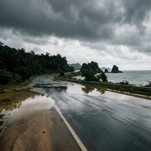
Plunging violently into the Andaman Sea, the western seaboard carves out a spectacular landscape of sheer cliffs and secluded coves. Pounding waves and shifting sediments have sculpted famous sandy stretches here, breathing life into iconic shores like Patong and Karon. Turning toward the east, the geography softens considerably as it rolls gently into the embrace of Phang Nga Bay. Thriving mangrove ecosystems, muddy estuaries, and vital tidal buffers dominate this eastern shoreline, creating a sanctuary for rich coastal marine life. Moving toward the southern tip, limestone outcrops pierce the horizon to offer a glimpse of classic karst formations, even as the region's signature granite continues to dictate the overarching geology.
Beyond the main shores, the territory shatters into a breathtaking archipelago comprising 32 smaller offshore islands and hidden islets. Covering just under 100 square kilometers combined, these scattered fragments range from coral-fringed atolls to dramatic rocky extensions. Explorers seeking rugged beauty flock to Ko Racha Yai, a stunning outpost of approximately 3.5 square kilometers defined by steep hills and vibrant fringing reefs, while the low-lying Ko Sire serves a more practical role by hosting local aquaculture. Protected marine reserves guard many of these uninhabited peripheral landforms, preserving a highly fragmented coastline where the continental shelf abruptly gives way to rapidly plunging oceanic depths.


Move around Phuket with ease using our guide to Bolt, the Smart Bus, and local ferries. Specific prices in THB and GBP for your first trip to the island.
FAQ: Phuket Travel Guide
What is the highest mountain peak in Phuket?
How much of Phuket's land is covered by tropical forest?
What is the difference between Phuket's east coast and west coast?
How many offshore islands belong to Phuket province?
What characterises the geography of Ko Racha Yai?
What rock types form the geology of Phuket?
Reviewed by the Thailand Guide Editorial Team • Last reviewed: 3 September 2026
This page is provided for general information only. While we aim for accuracy, details can change — please verify anything important independently before relying on it.