Western Thailand's limestone spine gives this province a raw, corrugated topography entirely unlike the flat central plains just next door.
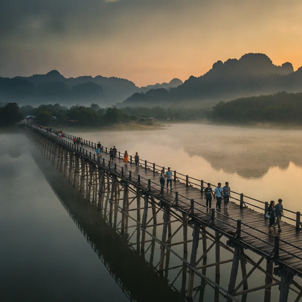
The reality is an intense valley heat trap formed by these parallel ridges, but this same geology creates the emerald tiers of Erawan that make the sweat entirely worthwhile. A third-class local train ticket deep into this dramatic jungle landscape costs just 100 THB (£2.20).
Covering exactly 19,483 square kilometres, the land forms a massive, jagged wedge pushing westward into Myanmar. The terrain is dominated by the Tenasserim Hills, a formidable limestone range that runs north to south like a heavily forested wall. Human habitation is almost entirely dictated by geology here. The vast majority of towns and villages cling tightly to the Y-shaped valley system carved by the Khwae Noi and Khwae Yai rivers, leaving the impenetrable karst interiors virtually empty. You can cross the main width of the populated lower valley in a 30-minute private taxi ride, which will set you back around 400 THB (£8.80). Beyond that narrow strip of civilisation, the land immediately rears up into steep, densely forested ridges that defy easy agricultural taming.
The western edge of the province is defined by the sheer, unyielding ridge of the Tenasserim Hills, acting as a natural geographical barricade against Myanmar. Reaching the furthest northern outpost at Three Pagodas Pass requires a winding, stomach-churning four-hour minivan journey from the provincial capital, costing roughly 175 THB (£3.80). This perimeter is a fiercely protected wilderness, comprising massive tracts of continuous forest reserve. Major portions of this borderland fall under the jurisdiction of Sai Yok, Erawan, and Khao Laem National Parks. The exact entry fee for foreigners to access these prime reserves is strictly 300 THB (£6.60), a price that funds the ongoing preservation of the watershed. The terrain here transitions from lowland bamboo thickets to dense evergreen mountain forest, with the border itself marked not by fences, but by the jagged crest of the mountain range where the watershed divides.
CONCRETE VS CANOPY
Roughly 80 percent of the province remains swathed in deep green, predominantly dense dry evergreen and monsoon forest mixed with towering bamboo scrubland. The concrete footprint is heavily concentrated in the flatter southern plains near the provincial capital. However, riverside resort construction is actively chewing into the secondary forest margins along the main rivers, losing a few hectares of natural riverbank each year to retaining walls and luxury villa plots. Despite this localised creep, the sheer verticality of the interior keeps the vast majority of the canopy completely safe from bulldozers. To properly understand the scale of the flora, a half-day guided nature trek through the primary canopy near the national parks costs around 1,200 THB (£26.50). You get what you pay for. The deeper you walk into the bamboo groves, the faster the sounds of highway traffic vanish entirely.
Hemmed in by Tak province to the north and Ratchaburi to the south, this is the exact frontier where the flat Thai central plains violently smash into the western mountains. The nearest major marine landmark is the Gulf of Thailand coastline, sitting roughly 160 kilometres south by road. To escape the mountains and reach the flatlands of neighbouring Suphan Buri, a standard air-conditioned regional bus costs roughly 60 THB (£1.30).
VERTICAL LIMITS & VIEWPOINTS
Khao Chang Phueak punches into the sky at exactly 1,249 metres, offering a razor-sharp limestone ridge walk that drops sharply into deep valleys on both sides. Regional building regulations strictly prohibit permanent concrete structures on slopes exceeding 35 degrees. This sensible rule preserves the upper sightlines from rampant hilltop villa development, keeping the ridgelines looking wild. Hiring a local songthaew truck to haul you up the brutal, winding gradients to the Pilok village viewpoint near the border costs roughly 1,500 THB (£33.00) for a private round trip.
HYDROLOGY & WATERWAYS
The entire landscape is defined by the flow of the Khwae Noi and Khwae Yai rivers, which eventually merge to form the Mae Klong. The upper reservoir waters of Vajiralongkorn run a glassy jade green, though the lower rivers turn opaque brown with heavy silt during the October monsoon. Lower riverbanks frequently breach during this time, though the waters recede quickly. For baseline hydration in this humid river valley, a one-litre bottle of local water from a 7-11 costs 15 THB (£0.33).
The relentless mountain gradients north of the main city will absolutely murder a standard scooter's fuel economy. Deep laterite mud makes the unpaved secondary tracks towards the border nearly impassable in late October, but sticking to the fully paved Highway 323 guarantees safe year-round access through the valleys. A 150cc mountain-rated scooter rental costs 500 THB (£11.00) per day. This is a highly necessary upgrade over the standard 110cc town models available for 250 THB (£5.50), saving you from having to push your bike up the steeper ascents.