Pattaya's geography defies expectations. Beyond flat beaches, undulating limestone ridges rise inland, offering panoramic bay views. Pratumnak Hill reaches 120 metres, defining this diverse coastal terrain.
Geography of Pattaya
Most visitors think of this eastern gulf stretch as flat, concrete-packed beachfront, but they completely miss the undulating limestone ridges that rise sharply just two kilometres inland to offer cool breezes and panoramic views of the bay.
The real topographical surprise is the steep, crescent-shaped bowl of the shoreline which naturally traps the sea breeze while creating a dramatic amphitheatre effect for sea-facing properties. It makes for an incredibly dramatic sundown view from the ridges, giving you the rare combination of a high-altitude coastal retreat and immediate access to a deep-water bay.
PHYSICAL BLUEPRINT OF THE BAY
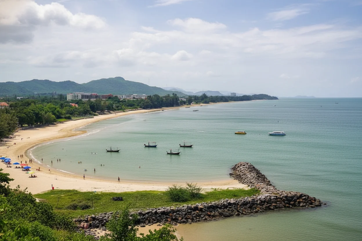
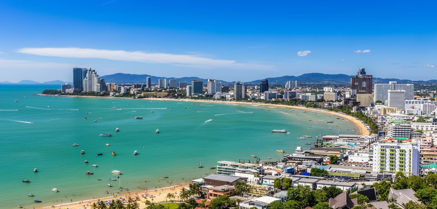
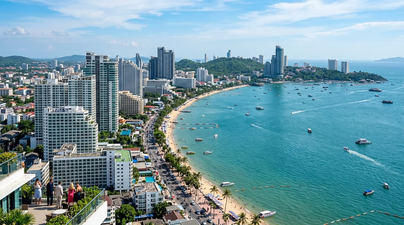
This coastal strip, home to the municipality of Pattaya, spans roughly 53 square kilometres of highly varied terrain. It resembles a long, narrow ribbon of flat alluvial plain squeezed tightly against a backdrop of low sedimentary hills to the east. The primary geological feature dictating where people set up camp is the sharp granite ridge of Pratumnak Hill. This rocky outcrop effectively splits the territory into two distinct bays, forcing dense, high-rise developments along the narrow, flat beachfronts while sending expansive residential estates outward toward the gentler eastern plains near Mabprachan. Getting across this territory from the northern headland of Naklua down to the southern reaches of Na Jomtien takes about thirty minutes in a private air-conditioned taxi, setting you back roughly 400 THB, which is about £9.20 at current exchange rates. This journey shows you just how quickly the flat maritime basin transitions into rolling clay-soiled hinterlands.
THE COASTLINE AND PERIMETER
The western edge is defined by a 15-kilometre sweep of coastline on the Gulf of Thailand, where the sand transitions from a coarse, golden grit in the north at Naklua to a much finer, powdery silt along the southern Jomtien curve. The sea shelf here is remarkably shallow, dropping gently to a depth of only three metres for the first fifty metres from the high-water mark, before gradually plunging to fifteen metres as you head toward the deep shipping lanes. To the east, the municipal perimeter terminates at the highway lines, bordering agricultural hills. Just off the coast lie the protected granite islands of the Mu Ko Phai archipelago, managed by the Royal Thai Navy as a de facto marine reserve where pristine coral thrives. To set foot on these outer island perimeters via a private long-tail boat charter, expect to pay around 1,500 THB, or roughly £34.50. For those looking to explore the nearby green lung of Khao Kheow National Forest just on the provincial border, the foreigner entry fee is 200 THB, which equals about £4.60, giving you access to ancient dry evergreen forests.
CONCRETE VS CANOPY
The division of the landscape is currently a tale of two halves, with approximately 60 percent of the coastal fringe dominated by concrete, glass, and tarmac, leaving 40 percent as green canopy. This green space is concentrated heavily on the eastern hillsides, characterised by hardy monsoon scrubland, dense bamboo groves, and small pockets of coastal mangrove forests along the Naklua canal. While rapid development has historically eaten into the natural foliage, strict new zoning laws around the eastern reservoirs are successfully preserving the remaining canopy. To experience what the local flora looks like when fully preserved, a visit to the sprawling Nong Nooch Tropical Garden costs 500 THB, or about £11.50 for an adult foreigner ticket. Walking through these preserved sections offers a clear view of the native Cycad species and broad-leaf palms that once covered this entire coastal plain before the builders arrived.
REGIONAL ANCHORING
This coastal enclave is anchored within Chonburi Province, bordered by the agricultural heartlands of Rayong to the south and the industrial hubs of Chachoengsao to the north. Directly west lies the open expanse of the Bay of Bangkok. For a geographic frame of reference, you are sitting exactly 45 kilometres north of Cape Liant, the rugged granite headland that marks the eastern entrance to the inner Gulf of Thailand.
VERTICAL LIMITS AND VIEWPOINTS
The highest natural peak in the immediate municipal boundary is Pratumnak Hill, rising to a modest but commanding 120 metres above sea level. Further east, the terrain climbs toward the Khao Maikaeo ridges, topping out at 140 metres. These sudden elevation rises feature sharp gradients of up to 15 percent, which has led local authorities to restrict any building taller than fourteen metres on the steepest crests to prevent landslide risks. Taking a local songthaew up to the top of the Pratumnak viewpoint costs 100 THB, or £2.30, where you can feel the immediate drop in temperature.
HYDROLOGY AND WATERWAYS
The local water system is dominated by the massive Mabprachan Reservoir to the east and the historical Khlong Naklua canal to the north. While coastal water clarity varies near the urban shoreline, it clears up beautifully just five kilometres out. Heavy monsoon rains can temporarily overwhelm the low-lying coastal roads for about an hour, but the newly upgraded municipal pump systems drain this off swiftly. A one-litre bottle of water from the local 7-Eleven costs 15 THB, roughly £0.35.
TOPOGRAPHICAL TOLL
Negotiating the steep, winding roads of the ridge lines requires a bit of mechanical strategy. Standard 110cc scooters will struggle and guzzle fuel on the 15 percent inclines of Pratumnak, and autumn rain can make the unpaved eastern clay trails quite slick. To navigate these slopes with ease, skip the basic scooters and rent a sturdier, mountain-rated 150cc scooter with high-torque transmission. A standard scooter costs about 200 THB, or £4.60 a day, whereas a mountain-rated model goes for 500 THB, roughly £11.50, saving both your brakes and your nerves on the steep descents.